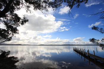


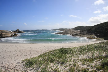
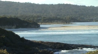
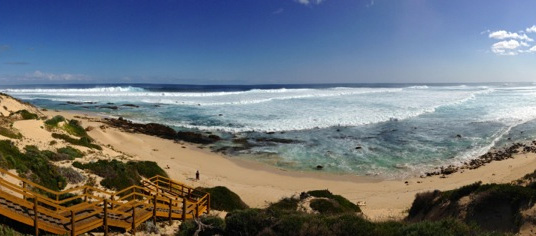
Madfish Bay
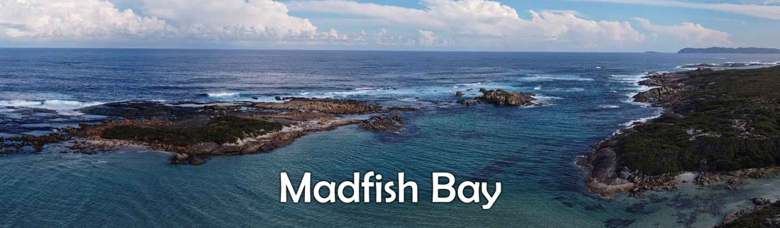
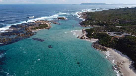
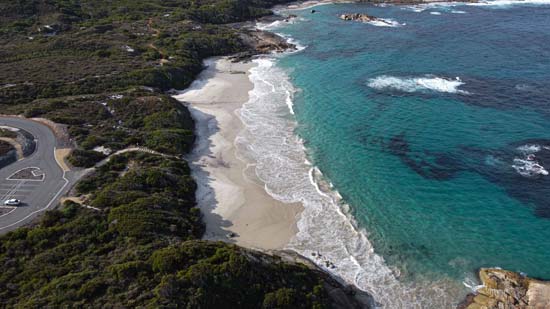
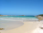
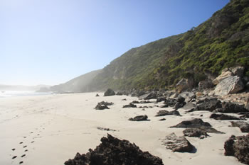
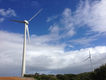
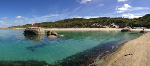
Madfish Bay and Madfish Bay Beach are beautiful locations to visit on the eastern end of William Bay National Park. Madfish Beach is a secluded little beach surrounded by rock formations which offer a unique view over Wilson Head and the Denmark Community Windfarm.
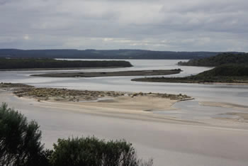
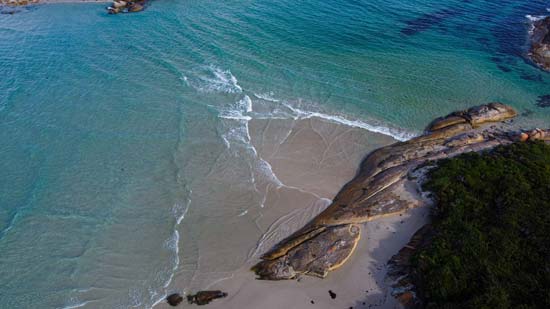
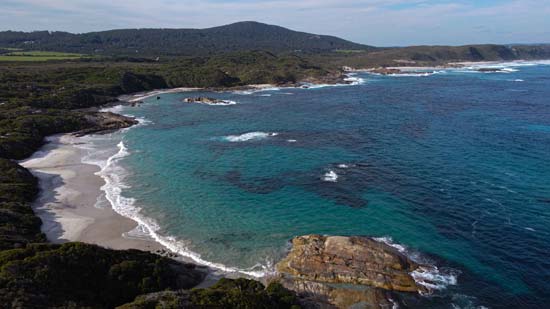
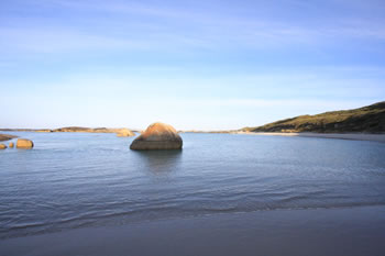
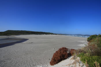
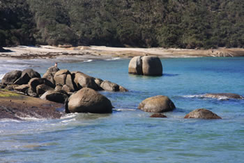
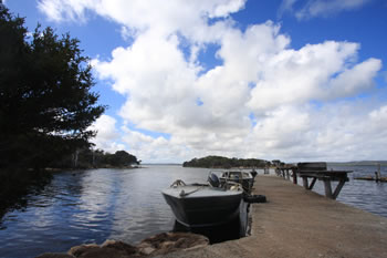
At low tide it is possible to walk directly across to the small island in Madfish Bay, but at high tide the island is completely cut off from the mainland. This island is known to house snakes, so be extremely careful if you decide to walk across to the island.
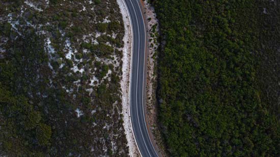
Madfish Bay is easily accessed by turning left (away from Greens Pool) and continuing along the bitumen road to the east. Madfish Bay and Waterfall Beach are right next to eachother.
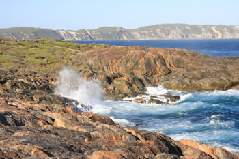
The waves at this beach come from two different directions around the island and make an incredible sight when the waves collide, especially during high-tide. Madfish Bay is a popular destination for cyclists who cycle between Greens Pool and Madfish Bay regularly. Madfish Bay is also along the Bibbulmun Track which winds across the countryside to Albany, its southern terminus.
Fishing?
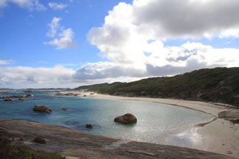
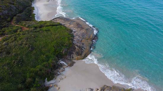
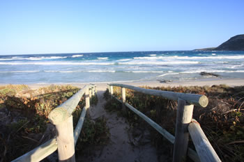
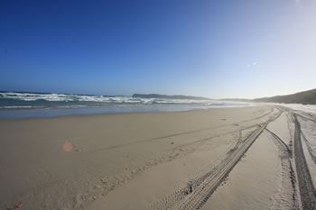
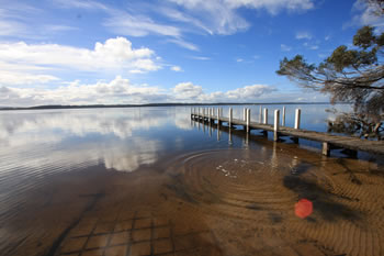
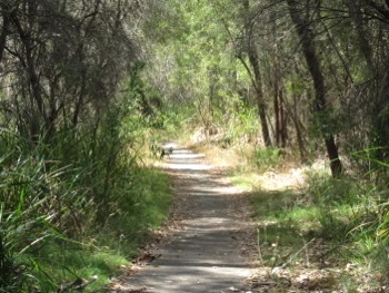
Many fish are known to inhabit the waters around Madfish Bay including whiting, bream and salmon. We could see a few schools in the shallow waters from the car park pathway. The descent from the car park is a sand and wood staircase leading directly on to the beach.
View a Map to Madfish Bay on the
William Bay National Park Map
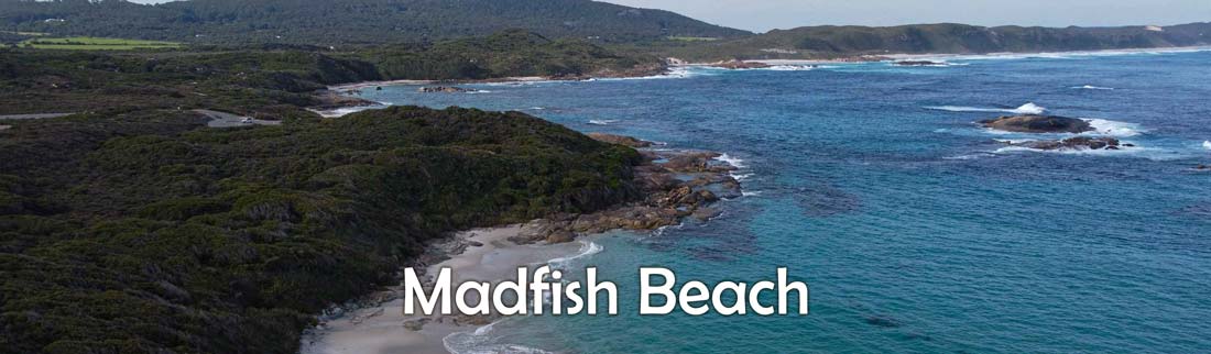
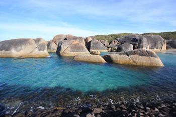
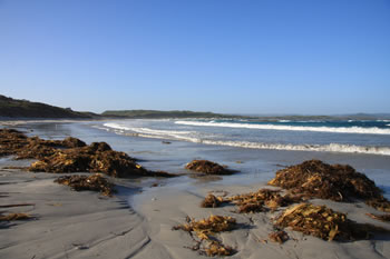
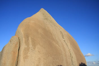
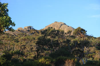
Both sides of the beach are constrained by the ancient rock formations dating back from when this part of Australia split away from Antarctica during the breakup of Gondwana, the southern supercontinent.
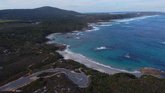
PARKING:
There is one car park at Madfish Bay, and a gradual
sloping staircase to descend to the beach.
SAFETY:
The Great Southern Ocean can be a few degrees colder
than the other oceans, so if you intend to snorkel
we recommend a wet suit.
GETTING THERE:
Madfish Bay is on the Williams Bay National Park Map
Located 15k West of Denmark along the South Coast
Highway. See the William Bay National Park Map
Madfish Bay Videos:
Other Natural Attractions in William Bay National Park, Denmark
 Greens Pool
 Almost completely sheltered from the waves of the Great Southern Ocean, Greens Pool is a paradise. Visit Greens Pool
 Elephant Rocks
 Giant rocks shaped like elephants stand together facing into the waves of the Great Southern Ocean Visit Elephant Rocks
 Hillier Beach
 Hillier Beach, on Hillier Bay, is located less than a kilometre South of Parry Beach along Parry Beach Road. Visit Hillier Beach
 Madfish Bay
 In Madfish Bay an island rests close to the shore. The waves at this beach come from two different directions. Visit Madfish Bay
 Mazzoletti Beach
 Mazzoletti Beach stretches from Greens Pool in the East by foot to Parry Beach in the West by car where it crosses the Parry Inlet at Parry Beach Visit Mazzoletti Beach
 Parry Beach
 Offering spectacular views across William Bay towards Green Pool and Elephant Rocks. Camping permitted if available. Visit Parry Beach
 Parry Inlet
 From the lookout you can see the forested hills of William Bay National Park. Visit Parry Inlet
 Tower Hill
 Located a kilometre north of Greens Pool and Elephant Rocks at the eastern side of William Bay National Park. Visit Tower Hill
 Waterfall Beach
 With beautiful turquoise waters the waterfall cascades from the heathland onto the beach and out to sea. Visit Waterfall Beach
Attractions in Denmark and surrounds:
 Ocean Beach
 Ocean Beach is set between the Wilson Inlet and the Great Southern Ocean, and is the closest beach to Denmark Town. A popular surfing spot and lookout.. Visit Ocean Beach
 Denmark Town
 In the heart of the Rainbow Coast on the north side of the Wilson Inlet, along the beautiful Denmark River. Visit Denmark Town
 The Wilson Inlet
 This majestic Inlet is divided from the ocean by a sandbar which covers the opening much of the year. Visit The Wilson Inlet
 Anvil Beach
 Anvil Beach is a beautiful beach on the south side of Nullaki Peninsula on the Great Southern Ocean. Visit Anvil Beach
 Crusoe Beach
 A commercial fishing site, the beach is best visited after 3.30pm as advised by the sign. Visit Crusoe Beach
 Denmark Windfarm
 The Denmark Community Windfarm sits atop Wilson Head just a bit south-west of Ocean Beach and the Wilson Inlet. Visit Denmark Windfarm
 Harewood Forest Walk
 Harewood Forest is an almost 1.5k walk through the forest. The stream at the end is the turn-around point. Filled with information on history, flora & fauna. Visit Harewood Forest Walk
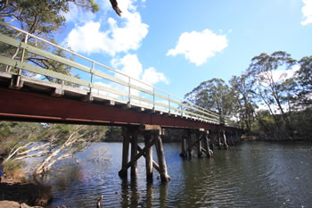 Heritage Rail Bridge
 The Bridge is easily accessed by driving south along the river on Hollings Drive where you will find parking spaces, picnic tables and a gazebo. Visit Heritage Rail Bridge
 Lights Beach
 Inspiring lookout and beach offering spectacular views of William Bay from the east. A favourite local beach. Visit Lights Beach
 McGearys Rock
 McGearys Rock is a popular rock fishing location close to Ocean Beach. It offers panoramic views of the bay and Nullaki Peninsula to the east. Visit McGearys Rock
 Mokare Heritage Trail
 Named after an aboriginal tracker and chieftain, the Mokare Heritage Trail winds along the east side of the Denmark River. Visit Mokare Heritage Trail
 Monkey Rock
 Spectacular elevated views over William Bay Nat. Park, Ratcliffe Bay, Ocean Beach and the Nullaki Peninsula. Visit Monkey Rock
 Prawn Rock Channel
 Prawn Rock Channel is located just north of Ocean Beach (you drive right past it on your way to Ocean Beach). This secluded slow-running channel of water is an ideal swimming spot. Visit Prawn Rock Channel
 Wilson Head
 Wilson Head marks the eastern perimeter of Ratcliffe Bay, stretching out into the Great Southern Ocean. Visit Wilson Head
 Denmark Accommodation
 An inspiring selection of quality accommodation of all types. Friendly service. Choose from a variety of great accommodation in and around Denmark, WA. Find Accommodation in Denmark NOW! Visit Denmark Accommodation
 Denmark Wineries
 Denmark Wineries and Vineyards to visit while on holiday along the Rainbow Coast. Wineries with restaurants, music, cellar doors and more! Visit Denmark Wineries
Accommodation in Denmark?


Other amazing locations in the South-West of Western Australia!
More information on the south-west coast in our other Western Australian travellers guides:
Albany Tourist Information:
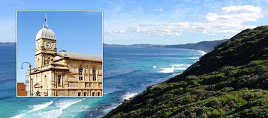
Albany WA
The Albany is the oldest settlement in Western Australia. Filled with history, surrounded by beaches and waterways, and a great place to visit while on holiday on the south coast of WA. Visit Albany today.
Have you visited?
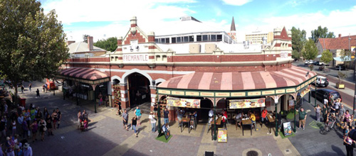
Fremantle WA
Fremantle, the Port City, is located south-west of Perth at the mouth of the Swan River. Fremantle's vibrant nightlife, music scene and cafe' culture make Fremantle a perfect getaway from the bustle of Perth. Beaches, history, shopping, dining out, and more. VISIT FREMANTLE
Have you visited?
Margaret River, WA
The Margaret River Region is an area of magnificent beauty on the western coast of the south west of WA. From the expansive shores of Busselton on Geographe Bay, through Dunsborough & Margaret River to Augusta, the Margaret River Region is fantastic. VISIT MARGARET RIVER
Have you visited?
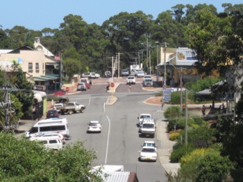
Denmark WA
Denmark WA is one of the most beautiful places along the south coast as it has forests, beaches, rivers and waves. Everything you need for the perfect south coast holiday. Denmark Wineries are popular too! Info on Denmark Town including shopping, dining & history, VISIT DENMARK WA