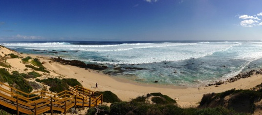


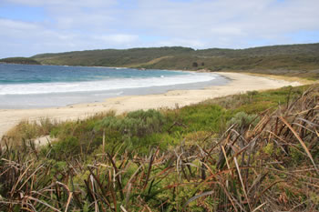
Shelley Beach
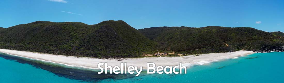
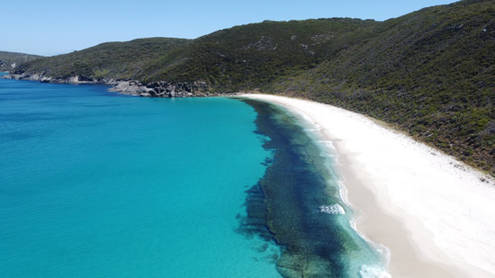
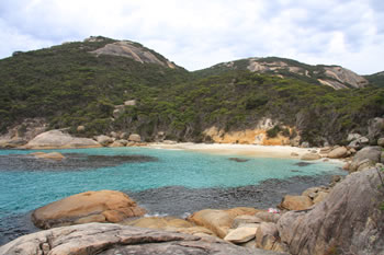
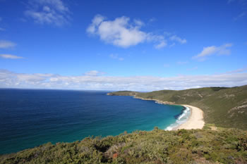
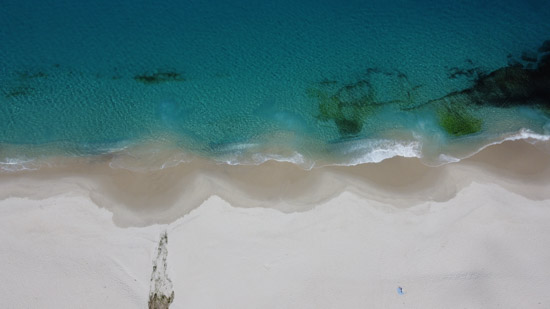
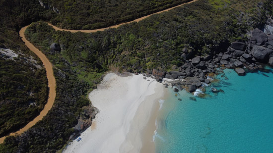
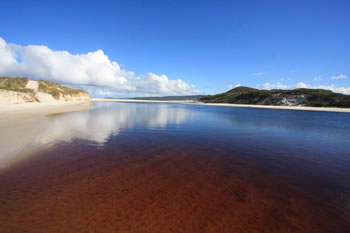
Shelley Beach in West Cape Howe is a beautiful and powerful beach along the waters of Torbay. The turquoise waters, verdant surrounds and ocean breeze make this beach a popular yet remote destination.
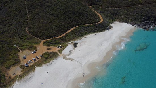
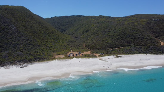
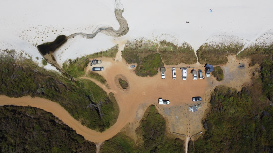
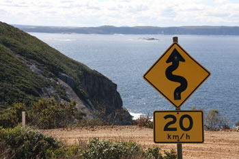
The beach and lookout are located just south of Cosy Corner along Coombes and Shelley Beach Roads, Shelley Beach has a large car park set just behind the beach.
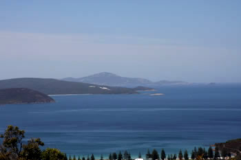
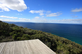
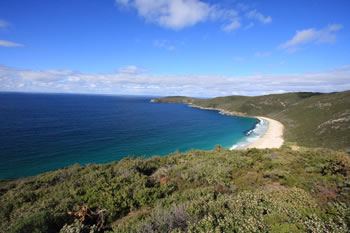
Above, the Shelley Beach Lookout is worth a visit for it's views across Torbay and Torbay Head to the south, and of Torndirrup Peninsula, the Albany Wind Farm and The Gap across the water to the west.
![]() The West Cape Howe National Park Map may help you get your bearings.
The West Cape Howe National Park Map may help you get your bearings.
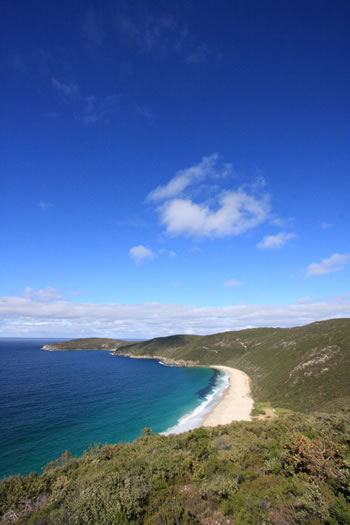
Shelley Beach is one of those amazing locations that is a must see when in the Albany Region.
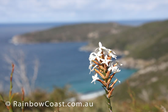
The white sandy beaches, rocky headlands covered with green, huge waves and amazing views make Shelley Beach memorable.
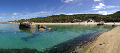
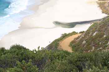
From Shelley Beach Lookout (above the beach) you can see the southern most point of Western Australia, Torbay Head in West Cape Howe.
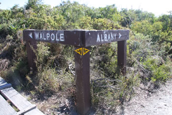
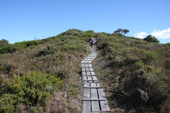
The Bibbulmun Track crosses the Shelley Beach Lookout walking trail allowing you to head west to Walpole or East to Albany. View the Maps on the Bibbulmuntrack.org.au for: Walpole or Albany.
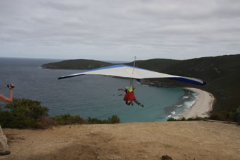
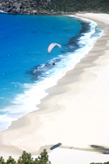
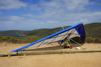
Hang Gliders are commonly seen soaring above the beach as there are professional platforms for hang gliding and paragliding on the Lookout.
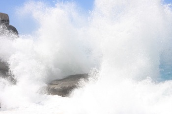
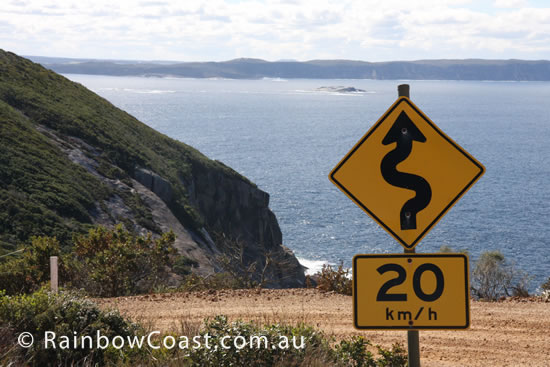
The Great Southern Ocean is unpredictable, sending surges even at calm times. BE AWARE when close to the water or cliff edges. LIVES HAVE BEEN LOST, so pay attention!
Visiting West Cape Howe National Park
The national park is run by the Department of Parks and Wildlife. Information on camping or commercial access should be accessed through them: https://parks.dpaw.wa.gov.au/
Shelly Beach Lookout
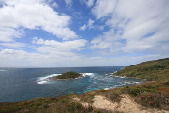
Shelley Beach Lookout is located high above Shelley Beach in West Cape Howe National Park offering amazing views of the eastern side of the park, the start of several trails and of course the ability to fly, if you have a hang glider or paraglider. It's a pretty awesome place.
Shelley Beach in West Cape Howe is a beautiful and powerful beach along the waters of Torbay. The turquoise waters, verdant surrounds and ocean breeze make this beach a popular yet remote destination. The beach and lookout are located just south of Cosy Corner along Coombes and Shelley Beach Roads, Shelley Beach has a large car park set just behind the beach. Above, the Shelley Beach Lookout is worth a visit for it's views across Torbay and Torbay Head to the south, and of Torndirrup Peninsula, the Albany Wind Farm and The Gap across the water to the west.
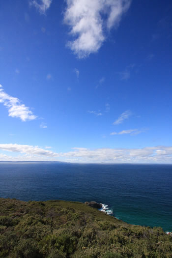
Shelley Beach Lookout is amazing as you can see far across Torbay into the Great Southern Ocean as well as get a wonderful view of Shelley Beach itself.
Fly into the Bight?!! Shelley Beach Lookout is also cool because it is from here where people FLY. Two large wooden platform / ramps, purpose built for hang gliding and paragliding, lead off into the air from the western end of the Great Australian Bight. The Great Australian Bight is defined as a line joining West Cape Howe (ta da!) to South West Cape in Tasmania, 2, 640km (1640mi) to the east. You also get a great view of Torbay Head, out on the point of West Cape Howe, the most Southern Point in Western Australia. The Bibbulmun Track passes directly through the Shelley Beach Lookout with pathways from Albany and Walpole directions meeting less than 50metres from the carpark.
 West Cape Howe National Park
 Containing the southernmost point of Western Australia this national park is astounding. Visit West Cape Howe National Park
 Shelley Beach
 Turquoise waters, verdant surrounds and ocean breeze make this beach a popular yet remote destination. Visit Shelley Beach
 Shelley Beach Lookout
 A beautiful scenic lookout with hang gliding and paragliding platforms. Visit Shelley Beach Lookout
 Cosy Corner
 White beaches plus camping facilities and lots of picnic benches. Cosy Corner is cosy indeed. Located just east of West Cape National Park between Albany and Denmark. Visit Cosy Corner
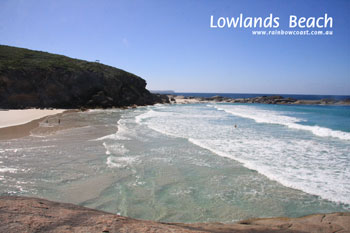 Lowlands Beach
 Beautiful, secluded beach west of West Cape Howe and east of the Wilson Inlet. Visit Lowlands Beach
 Forsyth Bluff
 This eastern most end of the National Park is rugged with large waves and waist to head high heathland. Visit Forsyth Bluff
Forsyth Bluff Forsyth Bluff gives a wonderful view out over the top of the bluff, only metres from the car park. Visit Forsyth Bluff
 Torbay Inlet
 Many people find Torbay to be one of the most relaxing and peaceful places along this stretch of coastline. Visit Torbay Inlet