


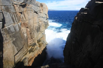
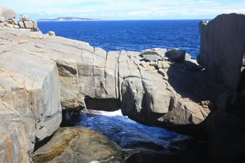
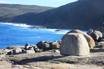
The Blowholes are crevasses in the granite stretching down to sea level far below. With each wave the 'holes' blow air and water up the channel and out the top creating a burst of spray and a loud droning whoosh! Watch the video below.
The rocks of this coastline were once connected to Antarctica when Australia was part of the supercontinent Gondawana. The rocks around the blowholes were created some 1800 million years ago. The blowholes are due to gradual erosion by the southern ocean.
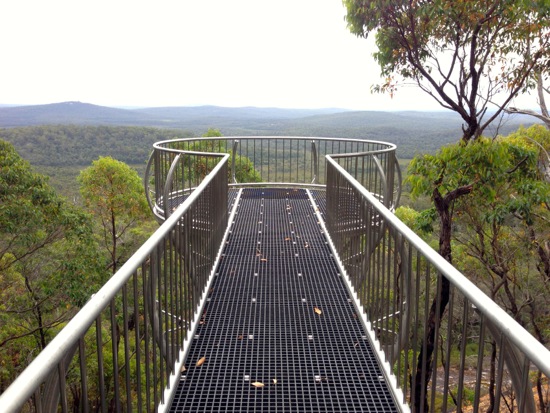
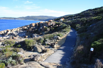
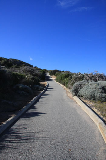
The carpark is quite a distance from the Blowholes. To reach them you need to walk a few hundred metres to the top of a long flight of stairs. From there you can walk along a wide, sealed paved pathway to the rocks. Stroll across the rocks and look towards the ocean and you will certainly here and see the blowholes at work. There is a sign at the beginning of the walk for you to tell whether the blowholes are 'blowing' on the day you visit.
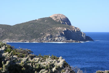
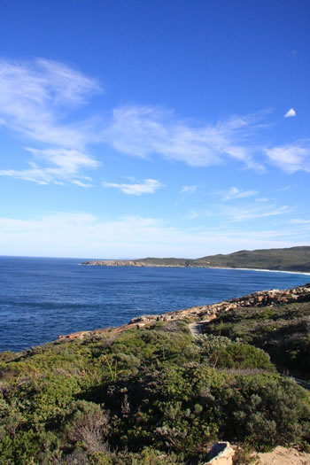
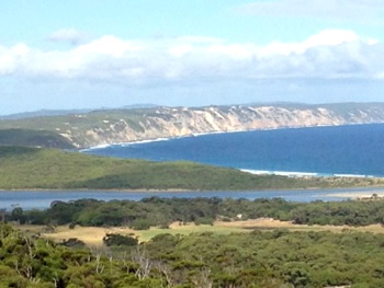
Only a short drive on from The Gap and Natural Bridge, The Blowholes is a very pleasant walk with amazing views of Bald Head and the Great Southern Ocean.

Video of the Blowholes, Torndirrup NP
This video takes you straight into the Blowholes and gives you an idea of the sound that comes from this crevasse in the granite coastline...
Getting to Torndirrup NP and The Blowholes
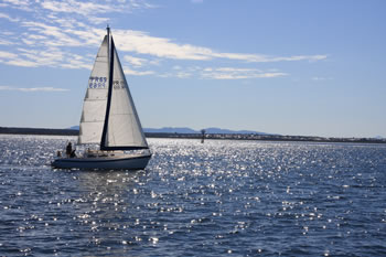
Albany is the nearest town located 15km to the north of Torndirrup via Frenchman Bay Road. The drive takes you around the western edge of Princess Royal Harbour and along the tree-lined peninsula towards all of the natural attractions of Torndirrup National Park. It is a beautiful and easy drive from Albany.
Torndirrup National Park Attractions:
 Torndirrup National Park
 Including The Gap, Natural Bridge, The Blowholes, Jimmy Newells Harbour, Stony Hill, Cable Beach & Stony Hill. Visit Torndirrup National Park
 Natural Bridge
 The Natural Bridge is a granite formation caused by the gradual wearing away of the rock by the Great Southern Ocean. Visit Natural Bridge
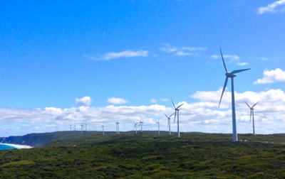 Albany Wind Farm
 Beautiful and productive green energy from the wind of the Torndirrup, just outside Albany City towards Frenchman Bay. Visit Albany Wind Farm
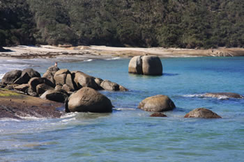
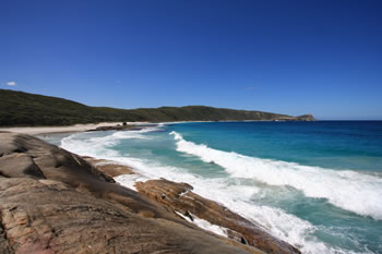 Cable Beach
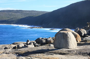
 In the middle of the beach is a giant boulder which was lifted by the sea and placed onto the beach by the force of the waves. Visit Cable Beach
 Former HMAS Perth Dive Wreck
 The Location of the Former HMAS Perth Dive Wreck for scuba divers. Visit Former HMAS Perth Dive Wreck
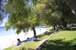
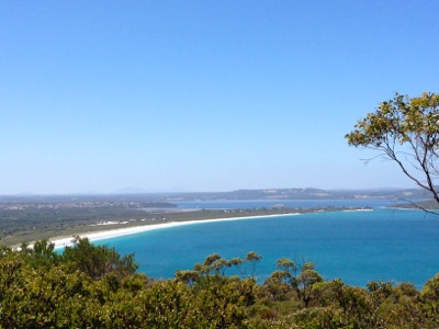
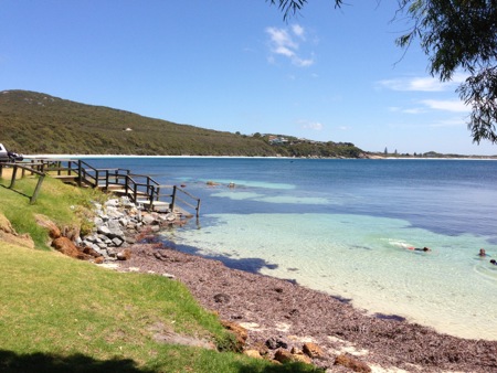 Frenchman Bay
 Located on the southern side of King George Sound this beautiful setting has a grassy picnic area, BBQs and boat launch. Ideal beachfront location for a great day out! Visit Frenchman Bay
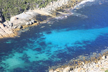 Jimmy Newells Harbour
 Jimmy Newells Lookout provides a breathtaking view of the harbour and great southern ocean. Visit Jimmy Newells Harbour
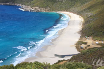
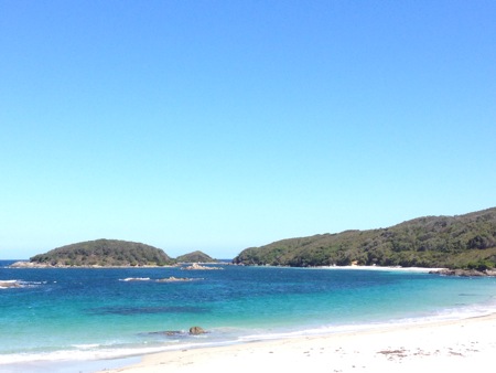
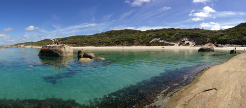
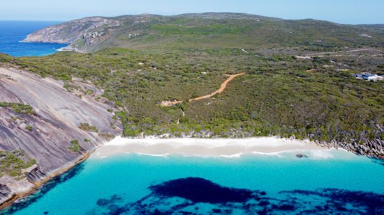 Misery Beach Albany
 Misery Beach is a hidden gem on the southern coast of Western Australia known for stunning natural beauty and a tranquil atmosphere. Visit Misery Beach Albany
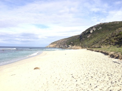 Salmon Holes
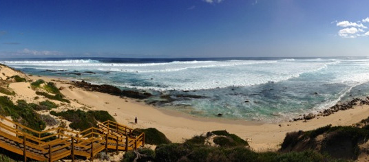
 Salmon Holes in Torndirrup NP offers incredible views from the lookout or descend to the white beach. Popular beach and rock fishing location. Visit Salmon Holes
 Stony Hill
 Stony Hill has a fabulous 500m fairly level circular walk which offers spectacular 360 degree views. Visit Stony Hill
 The Blowholes
 The Blowholes are crevasses in the granite stretching down to sea level far below. With each wave the holes blow air and water up the channel. Visit The Blowholes
Attractions in Albany and surrounds:
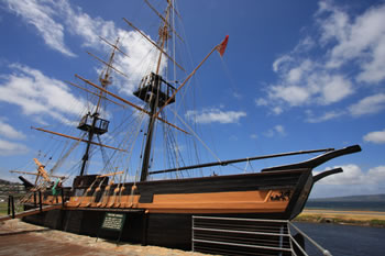 Brig Amity Replica
 Experience the first settlers arrival in Albany, the first settlement in Western Australia, from onboard a replica of the Amity. Visit Brig Amity Replica
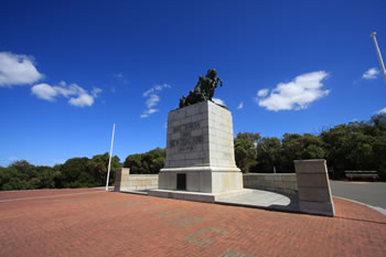 Mount Clarence
 Visit the ANZAC Desert Corps Memorial and view the coast from Padre White Lookout or Apex Lookout at the summit. Visit Mount Clarence
 Middleton Beach
 The most popular beach in Albany. Swim or relax under the trees. Cafes and amenities. Visit Middleton Beach
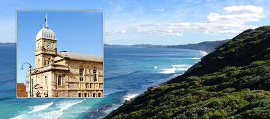
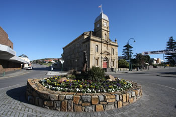 City of Albany
 Located between the hills of Mount Melville and Mount Clarence, the Nestled along the Princess Royal Harbour & King George Sound. Visit City of Albany
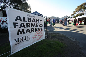 Albany Farmers Market
 Saturday mornings. Fresh fruit and veggies from local growers. Organic produce available. Visit Albany Farmers Market
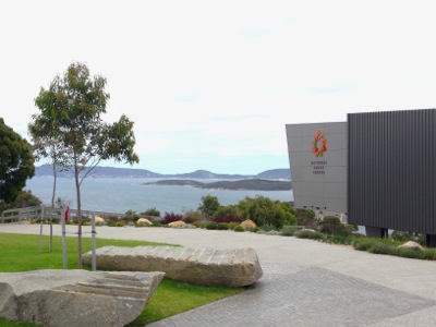 Albany Heritage Park
 The heritage park consists of the parklands and monuments of Mount Clarence and Mount Adelaide including the National ANZAC Centre. Visit Albany Heritage Park
 Albany Pier (Cruises & Whale Watching)
 Albany Pier for embarking on a whale watching tour. Visit Albany Pier (Cruises & Whale Watching)
Albany Wind Farm Beautiful and productive green energy from the wind of the Torndirrup, just outside Albany City towards Frenchman Bay. Visit Albany Wind Farm
ANZAC Desert Mounted Corps Memorial ANZAC Desert Mounted Corps Memorial sits atop Mount Clarence. Visit ANZAC Desert Mounted Corps Memorial
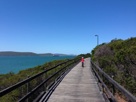
 Ellen Cove
 Ellen Cove, Ellen Cove Boardwalk and Ellen Cove Pier are at the far southern end of Middleton Beach, Albany. Visit Ellen Cove
Frenchman Bay Located on the southern side of King George Sound this beautiful setting has a grassy picnic area, BBQs and boat launch. Ideal beachfront location for a great day out! Visit Frenchman Bay
Misery Beach Albany Misery Beach is a hidden gem on the southern coast of Western Australia known for stunning natural beauty and a tranquil atmosphere. Visit Misery Beach Albany
 Oyster Harbour
 Oyster Harbour, on the north eastern side of Albany flows into the King George Sound past Emu Point. Visit Oyster Harbour
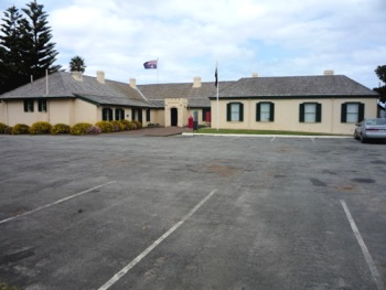
 Princess Royal Fortress
 One of the best outdoor military museums in Australia. The Fortress is within the Albany Heritage Park, atop Mount Adelaide. Visit Princess Royal Fortress
 Top 10 Places to Visit
 Filled with many magical and majestic natural wonders, the best places are on the coast to enjoy... Visit Top 10 Places to Visit
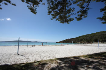
 Top Beaches
 Pristine, clean and just like paradise. Swim in the rock pools, swim in clear waters, secluded bays, or snorkel around giant boulders all on the Rainbow Coast. Visit Top Beaches
 Top Biking Locations
 Top locations along the coast to start a bike ride. Tap the markers for information about the locations on the Map below. Visit Top Biking Locations
Top Historical Locations The Rainbow Coast is a historical destination. These are the most historical places to visit. Tap the markers for information about the locations on the Map below. Visit Top Historical Locations
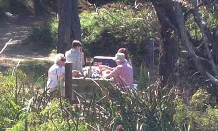 Top Picnic Spots
 Looking for a nice picnic spot, try these favourite picnic locations along the coast. Tap the markers for information about the locations on the Map below. Visit Top Picnic Spots
 Top Places for Dogs
 If you have brought your four legged friend with you on holiday then you will need to know when you can take them for exercise and fun. Visit Top Places for Dogs
 Top Places for Elders
 Accessible and elder-friendly locations along the south coast. Tap the markers for information about the locations on the Map below. Visit Top Places for Elders
 Top Places to Take Kids
 Kids love it on the Rainbow Coast. The spectacular coastline is family friendly and welcoming. Visit Top Places to Take Kids
 Top Surf Spots
 The waters of the spectacular Rainbow Coast are very tempting and there are quite a few places to catch the waves. Visit Top Surf Spots
 WA Museum Albany
 The Western Australian Museum Albany has exhibitions and information on the natural and social history of the region. Visit WA Museum Albany


Other amazing locations in the South-West of Western Australia!
More information on the south-west coast in our other Western Australian travellers guides:
Albany Tourist Information:
Albany WA
The Albany is the oldest settlement in Western Australia. Filled with history, surrounded by beaches and waterways, and a great place to visit while on holiday on the south coast of WA. Visit Albany today.
Have you visited?
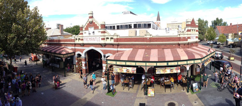
Fremantle WA
Fremantle, the Port City, is located south-west of Perth at the mouth of the Swan River. Fremantle's vibrant nightlife, music scene and cafe' culture make Fremantle a perfect getaway from the bustle of Perth. Beaches, history, shopping, dining out, and more. VISIT FREMANTLE
Have you visited?
Margaret River, WA
The Margaret River Region is an area of magnificent beauty on the western coast of the south west of WA. From the expansive shores of Busselton on Geographe Bay, through Dunsborough & Margaret River to Augusta, the Margaret River Region is fantastic. VISIT MARGARET RIVER
Have you visited?
Denmark WA
Denmark WA is one of the most beautiful places along the south coast as it has forests, beaches, rivers and waves. Everything you need for the perfect south coast holiday. Denmark Wineries are popular too! Info on Denmark Town including shopping, dining & history, VISIT DENMARK WA