


Nornalup Inlet, Walpole
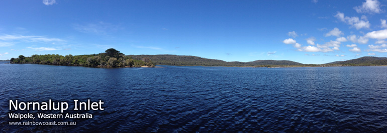
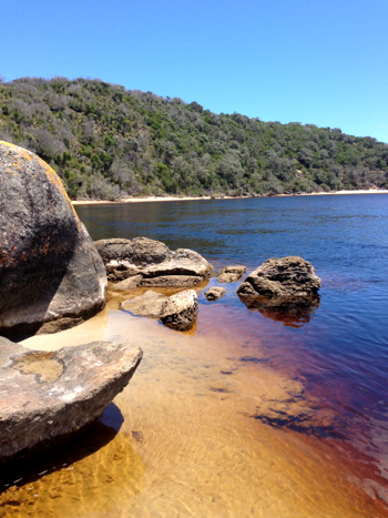
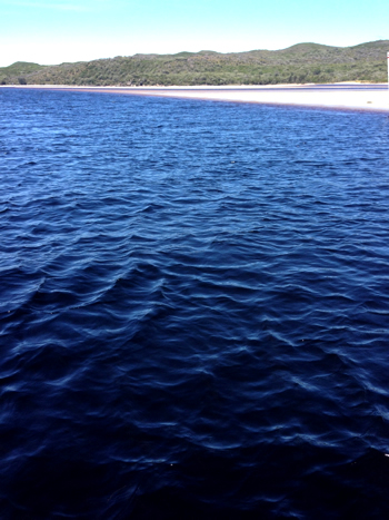
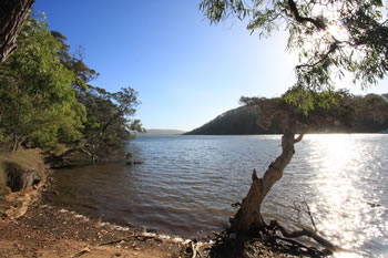
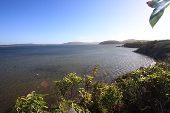
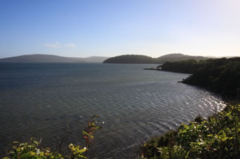
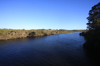
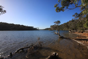
The Nornalup Inlet is serene. Fed from the Deep and Frankland Rivers as well as the Walpole Inlet by which is it connected via a natural deep water channel, it is one of the most beautiful waterways on the south coast.
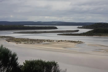
You can see the channel passing south from the Walpole Inlet to the Nornalup Inlet in the Map below.
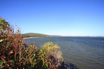
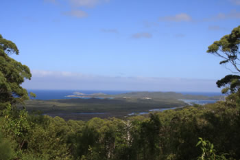
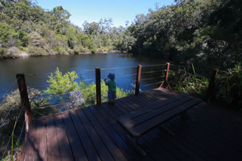
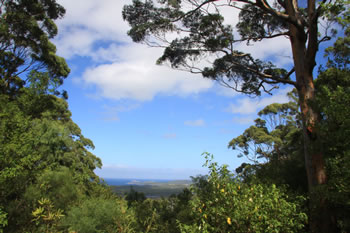
From The Knoll, the Nornalup Inlet is easily viewed from the platforms along the way. Picnic areas and toilets are available at "The Channels" parking area, about half way around the scenic drive.
If you've got the time, we recommend the Walpole Wilderness Eco Cruise for an amazing and informative time on the Walpole and Nornalup Inlets. A beautiful cruise across the Inlets and through The Channels.
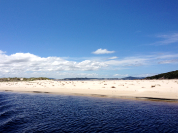
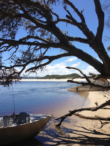
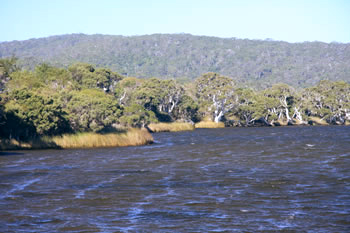
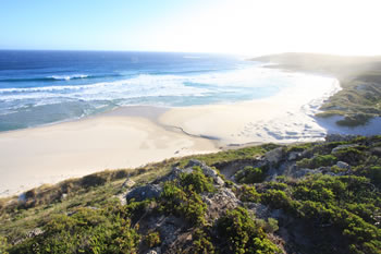
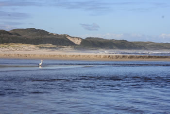
The Channels looking towards the Nornalup Inlet from the edge of the Walpole Inlet at The Channels.
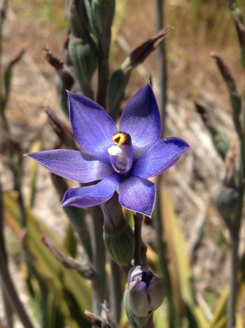
Thelymitra, sun orchid along the Nornalup Inlet. View more Wildflowers of the South Coast.
Fishing is a common recreational activity along the Nornalup Inlet. Details from the visitors centre.
Walpole and surrounds:
 Walpole Town
 At the northern edge of the Walpole Inlet, Walpole is one of the few towns on the path of the Bibbulmun Track. Visit Walpole Town
 Walpole Regional Map
 Map of the Walpole Region including places to visit and National Parks. Visit Walpole Regional Map
 Knoll Scenic Drive
 A five kilometre circular drive on the peninsula between the Walpole and Nornalup Inlets. A distinctly well-kept rest area with picnic tables & toilets. Visit Knoll Scenic Drive
 Stay in Walpole
 An inspiring selection of quality accommodation of all types. Friendly service. Choose from a variety of great accommodation in and around Walpole, WA. Find Accommodation in Walpole! Visit Stay in Walpole
Other attractions in the Walpole-Nornalup National Park:
 Walpole-Nornalup National Park
 Expansive covering over twenty thousand hectares of the Walpole Wilderness Area. Visit Walpole-Nornalup National Park
Walpole Town At the northern edge of the Walpole Inlet, Walpole is one of the few towns on the path of the Bibbulmun Track. Visit Walpole Town
 Ancient Empires Walk
 The Ancient Empires Walk takes you through the forest at the base of the Giant Tingle Trees at the Treetop Walk. Visit Ancient Empires Walk
 Circular Pool
 Family friendly swirling pools. Access via steps or a gentle paved pathway. Viewing platforms close to carpark. Visit Circular Pool
 Conspicuous Cliff
 Standing high above the surrounding heathland, the Cliff-top lookout gives fantastic views of the beach and river flowing into the sea. Visit Conspicuous Cliff
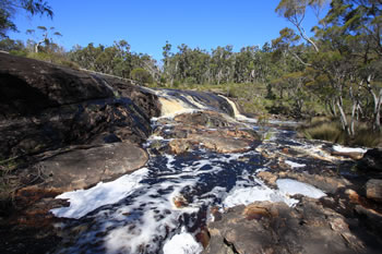 Fernhook Falls
 Located along the Deep River Fernhook Falls is a popular swimming and picnic spot in summer, and during winter is a truly magnificent sight! Visit Fernhook Falls
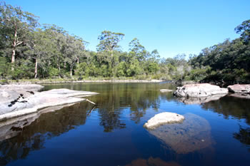
 Frankland River
 The Frankland River is the 8th largest in the state of Western Australia flowing into the Nornalup Inlet. Visit Frankland River
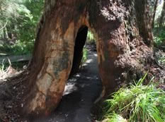
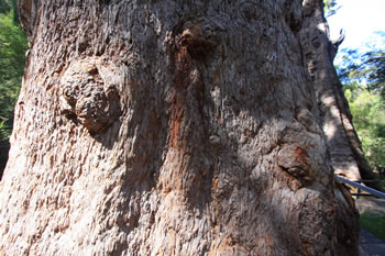 Giant Tingle Tree
 This Giant Tingle Tree is special because it the oldest living eucalypt in the world. It is an 800 metre walk from the car park to the Giant Tingle and back. Visit Giant Tingle Tree
 Hilltop Lookout
 On Hilltop Road, east of Walpole. Overlooking the Nornalup Inlet and Frankland River. Rocky Head and Saddle Island can be seen in the distance. Visit Hilltop Lookout
 Irwin Inlet
 Irwin Inlet carves the sandbars at Peaceful Bay due to the swift flow into the Southern Ocean. Visit Irwin Inlet
Knoll Scenic Drive A five kilometre circular drive on the peninsula between the Walpole and Nornalup Inlets. A distinctly well-kept rest area with picnic tables & toilets. Visit Knoll Scenic Drive
 Mandalay Beach
 Spectacular views to Chatham Island, gorgeous white sandy beach it is a must-see... sometimes the shipwreck is visible too. Visit Mandalay Beach
 Nornalup Inlet
 The Nornalup Inlet is serene. Fed from the Deep and Frankland Rivers it connects to the Walpole Inlet via a natural deep water channel. Visit Nornalup Inlet
 Peaceful Bay
 Peaceful Bay beach is split in two by the Irwin Inlet as it discharges into the ocean. Sand dunes abound. Visit Peaceful Bay
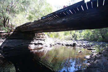 Sappers Bridge
 Re-built October 1982 for the National Parks Authority by 22nd Construction Squadron RAE following flood damage January 1982. Visit Sappers Bridge
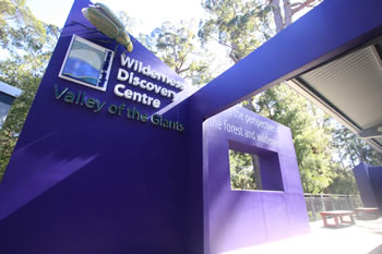 Valley of the Giants
 The Valley of the Giants Wilderness Discovery Centre at the Treetop Walk is the most visited place on the Rainbow Coast. Visit Valley of the Giants
 Walpole Inlet
 Filled by the Deep & Frankland Rivers, the dark waters of the Walpole Inlet empty into the Nornalup Inlet through the Channels. Visit Walpole Inlet
Accommodation in Walpole?


Other amazing locations in the South-West of Western Australia!
More information on the south-west coast in our other Western Australian travellers guides:
Albany Tourist Information:
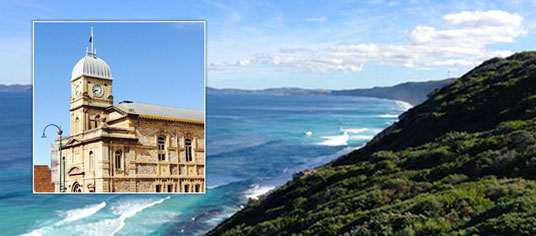
Albany WA
The Albany is the oldest settlement in Western Australia. Filled with history, surrounded by beaches and waterways, and a great place to visit while on holiday on the south coast of WA. Visit Albany today.
Have you visited?
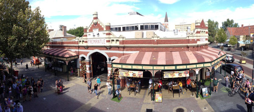
Fremantle WA
Fremantle, the Port City, is located south-west of Perth at the mouth of the Swan River. Fremantle's vibrant nightlife, music scene and cafe' culture make Fremantle a perfect getaway from the bustle of Perth. Beaches, history, shopping, dining out, and more. VISIT FREMANTLE
Have you visited?
Margaret River, WA
The Margaret River Region is an area of magnificent beauty on the western coast of the south west of WA. From the expansive shores of Busselton on Geographe Bay, through Dunsborough & Margaret River to Augusta, the Margaret River Region is fantastic. VISIT MARGARET RIVER
Have you visited?
Denmark WA
Denmark WA is one of the most beautiful places along the south coast as it has forests, beaches, rivers and waves. Everything you need for the perfect south coast holiday. Denmark Wineries are popular too! Info on Denmark Town including shopping, dining & history, VISIT DENMARK WA